Forest Hills, Florida Weather
|
|
|
|
|
|
|
|
 |
 |
 |
 |
 |
|
 |
 |
| High: °F |
Low: °F |
High: °F |
High: °F |
High: °F |
High: °F |
High: °F |
High: °F |
| Low: °F |
Low: °F |
Low: °F |
Low: °F |
Low: °F |
|
| Thunderstorms |
Thunderstorms |
Sunny |
Thunderstorms |
Mostly Sunny |
Sunny |
Thunderstorms |
Thunderstorms |
Current Conditions at
SANFORD - (KSFB)
73°
Clear
as of 5:53 AM EDST
Rel. Humidity: 88%
Dew Point: 70°F
Visibility: 10 Miles
Pressure: 29.90 in.
Flight Rule: VFR
Cloud Level(s): Clear
Current Conditions at
DAYTONA BEACH - (KDAB)
72°
Mostly Clear
as of 5:53 AM EDST
Rel. Humidity: 94%
Dew Point: 70°F
Visibility: 10 Miles
Pressure: 29.90 in.
Flight Rule: VFR
Cloud Level(s): Few at 16000ft
Current Conditions at
LEESBURG - (KLEE)
75°
Clear
as of 5:53 AM EDST
Rel. Humidity: 78%
Dew Point: 68°F
Visibility: 10 Miles
Pressure: 29.90 in.
Flight Rule: VFR
Wind Data
7 MPH
150° Southeast
Cloud Level(s): Clear
Current Conditions at
ORLANDO HERN APRT - (KORL)
73°
Clear
as of 5:53 AM EDST
Rel. Humidity: 88%
Dew Point: 70°F
Visibility: 10 Miles
Pressure: 29.90 in.
Flight Rule: VFR
Cloud Level(s): Clear
|
Today... A 10 percent chance of showers and thunderstorms after 5pm. Sunny and hot, with a high near 96. Light south wind becoming southwest 5 to 10 mph in the morning. |
|
|
Tonight... A 20 percent chance of showers and thunderstorms before 11pm. Partly cloudy, with a low around 71. South southwest wind around 5 mph. |
|
|
Thursday... Sunny and hot, with a high near 95. South southwest wind 5 to 15 mph, with gusts as high as 20 mph. |
|
 |
Thursday Night... Partly cloudy, with a low around 71. West wind 5 to 10 mph. |
|
|
Friday... A 40 percent chance of showers and thunderstorms. Mostly sunny, with a high near 91. West southwest wind 10 to 15 mph, with gusts as high as 25 mph. |
|
 |
Friday Night... A 30 percent chance of showers and thunderstorms before 2am. Partly cloudy, with a low around 67. West wind 10 to 15 mph, with gusts as high as 25 mph. |
|
|
Saturday... Mostly sunny, with a high near 88. West northwest wind 10 to 15 mph. |
|
 |
Saturday Night... Mostly clear, with a low around 62. West wind 5 to 10 mph. |
|
|
Sunday... Sunny, with a high near 88. North wind 5 to 10 mph. |
|
|
Sunday Night... Partly cloudy, with a low around 65. East northeast wind 5 to 10 mph. |
|
|
Monday... A 40 percent chance of showers and thunderstorms. Partly sunny, with a high near 85. East southeast wind 5 to 10 mph. |
|
 |
Monday Night... A 40 percent chance of showers and thunderstorms. Mostly cloudy, with a low around 67. East wind 10 to 15 mph. |
|
|
Tuesday... Showers and thunderstorms likely. Mostly cloudy, with a high near 85. South wind 10 to 15 mph, with gusts as high as 20 mph. Chance of precipitation is 60%. |
|
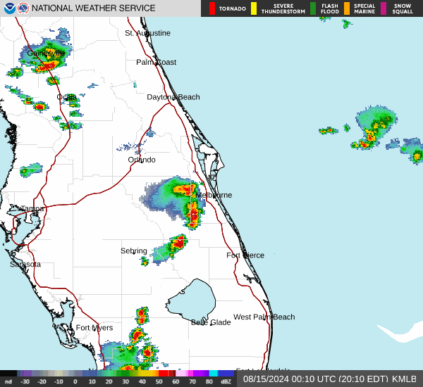
Current Radar Image
Sun Almanac for Forest Hills, Florida
Sunrise: 06:38 AM
Sunset: 8:06 PM
Civil Sunrise:06:13 AM
Civil Sunset: 8:32 PM
Nautical Sunrise: 05:42 AM
Nautical Sunset: 9:02 PM
Astro Sunrise: 05:10 AM
Astro Sunset: 9:34 PM
Florida's Current Temperatures
 Florida's Satellite Image
 Florida's Current Wind Direction
| National Summary |
of upper and lower values of current conditions amongst 7068 locations
in the contiguous United States |
|
High
Temp |
82° |
Key West NAS, Florida
and 3 other locations
|
|
Low
Temp |
30° |
Dubois Municipal, Wyoming
and 17 other locations
|
|
Wind
Speed |
47mph |
Salida Mountain, Colorado
|
|
Wind
Gust |
54mph |
Foxtrot, Montana
and 1 other location
|
|
Wind
Chill |
15° |
Elk Mountain, Wyoming
and 1 other location
|
|
High
Pressure |
30.43Hg |
Tillamook A/P, Oregon
|
|
Low
Pressure |
29.38Hg |
Dickinson, North Dakota
|
|
| # Locations Reporting Snow |
16 |
|
| # Locations Reporting Rain |
70 |
|
| # Locations Reporting Thunderstorms / Lightning |
14 |
|
| # Locations Reporting Fog |
45 |
|
| Average Temperature in the Contiguous USA |
58° |
|
Any use of the information on this page is at your own risk. This information should not be relied upon in life-threatening situations, potential financial loss situations or in lieu of any officially disseminated information. Visit the
National Weather Service for official information.